

The new Google Maps for desktop now lets you measure and calculate distance between two or more points on the map. To see the distance between points in the new Google Maps, use the right-click menu, and click on Measure Distance. Here's the step-by-step instructions:
1) Open the new Google Maps.
2 ) Right-click on your starting point.

3) Click Measure distance.
4) Click anywhere on the map to create a path you want to measure. Click to add additional measuring points.

5) [Optional] Drag a point to move it, or click a point to remove it.
6) Look on the map and under the search box for the total distance.

7) When done, click the “X” in the card under the search box or right-click on the map and select Clear measurement.

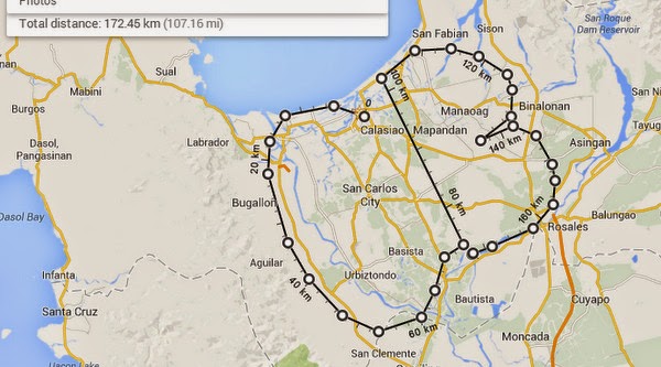
Ok, so I tried this useful tool and it took 107.16 miles just to draw to initials of CaidoBlogger. LOL!
1) Open the new Google Maps.
2 ) Right-click on your starting point.
3) Click Measure distance.
4) Click anywhere on the map to create a path you want to measure. Click to add additional measuring points.
5) [Optional] Drag a point to move it, or click a point to remove it.
6) Look on the map and under the search box for the total distance.
7) When done, click the “X” in the card under the search box or right-click on the map and select Clear measurement.
Ok, so I tried this useful tool and it took 107.16 miles just to draw to initials of CaidoBlogger. LOL!
[ Source: Google Maps ]

Post a Comment